Have you ever stopped to think about what would happen if your maps app simply "forgot" physics for a day?
If the GPS system ignored Albert Einstein's theories for a mere 24 hours, your location on the map would be off by about 10 kilometers. You could be in downtown São Paulo, and the map would swear you were diving into the Guarapiranga reservoir.
It sounds crazy, but it's pure physics.
Up there, at an altitude of 20,000 kilometers, satellites travel at 14,000 km/h. At this absurd speed, special relativity kicks in, and time passes more slowly for them (they lose 7 microseconds a day). At the same time, because they are far from Earth's gravity, general relativity makes time pass faster (they gain 45 microseconds).
The net result? The satellite's clock runs 38 microseconds faster than your wristwatch.
Since GPS locates you by measuring the time it takes for the signal to reach you at the speed of light, this tiny "error" in time translates into a 10 km daily geographic deviation. The genius of engineering is that every GPS chip does this mathematical correction silently. You never even notice.
But what happens when things get really serious? What if the location isn't for finding a pizzeria, but for enforcing the law?
The difference between "finding" and "proving" a location
For civilian use, being off by 5 or 10 meters isn't the end of the world. You look out the car window and adjust.
In traffic enforcement and rotary parking management, a 5-meter error is a legal disaster.
Imagine fining a vehicle for illegal parking. If the GPS coordinate attached to the infraction has the inaccuracy of an ordinary cell phone, the defense attorney will have a field day. "My client wasn't in the prohibited spot; the GPS made a mistake because of the tall buildings." And they might be right.
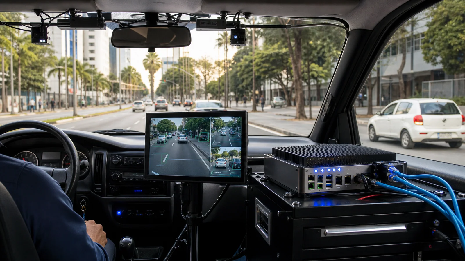
That's why cutting-edge enforcement technology doesn't just rely on 1915 physics. It needs a robust 21st-century data architecture.
The arsenal against GPS errors: GNSS Constellations
To ensure GPS accuracy in traffic enforcement, a single satellite system is not enough.
Professional equipment doesn't just look at American satellites (GPS). It simultaneously talks to GLONASS (Russia), BeiDou (China), Galileo (Europe), and NavIC (India). We call this multi-constellation GNSS systems.
By cross-referencing data from dozens of satellites across different constellations at the same time, we achieve what engineers call sub-meter accuracy. In other words, the margin of error drops to less than a meter, even in "urban canyons" (those streets full of skyscrapers that block the signal).
But physical accuracy is only half the battle. The other half is legal validity.
Pintrust and AreaChain: The vaccine against disputes
At Areatec, we understand that the exact coordinate is useless if someone can alter it on the way from the street to the city hall's system.
This is where Pintrust comes in. Our technology takes this ultra-precise location (based on multiple constellations) and applies a cryptographic certification at the source. The data is born shielded.
It's not just a coordinate in a database. It's a mathematical proof with legal geolocation validity.
To tie it all together, we use AreaChain, our private blockchain. It creates an inviolable digital chain of custody. From the moment the patrol vehicle (equipped with Olho Vivo Patrol) records the infraction until the ticket is processed, every step is immutably recorded.
The invisible technology that keeps cities running
Just as you don't think about Einstein's equations when you open the map on your phone, a public manager shouldn't have to worry if a fine will be canceled due to a technical failure.
Good technology is the kind that solves complex problems behind the scenes. The physics of 1915 keeps the satellite on track. Areatec's 2026 cryptography keeps enforcement incontestable.
The end result is the same: you trust the system, and it simply works.
Quick FAQ
Written by an engineer who prefers exact mathematics over legal headaches.
- Why does a cell phone GPS get the location wrong?
- Smartphone GPS suffers from the "multipath effect," where the satellite signal bounces off buildings before reaching the device, causing errors of 5 to 20 meters. Additionally, cell phones usually use fewer satellite constellations simultaneously.
- How do you ensure legal validity in the location of traffic infractions?
- It requires using sub-meter accuracy GNSS receivers (which access multiple constellations like GPS, GLONASS, and Galileo) combined with cryptographic certification of the coordinate at the time of capture, creating an immutable digital chain of custody.
- What is sub-meter accuracy?
- It is the ability of a geolocation system to determine a point on the globe with a margin of error of less than 1 meter. It is the required standard for rigorous enforcement and auditing systems.